Category:March 2016 in Massachusetts
Jump to navigation
Jump to search
English: Images/pictures taken in Massachusetts during March 2016. Note this is not the date of the upload, nor the date a photo was scanned.
States of the United States: Alabama · Alaska · Arizona · Arkansas · California · Colorado · Connecticut · Delaware · Florida · Georgia · Hawaii · Idaho · Illinois · Indiana · Iowa · Kansas · Kentucky · Louisiana · Maine · Maryland · Massachusetts · Michigan · Minnesota · Mississippi · Missouri · Montana · Nevada · New Hampshire · New Jersey · New Mexico · New York · North Carolina · North Dakota · Ohio · Oklahoma · Oregon · Pennsylvania · Rhode Island · South Carolina · South Dakota · Tennessee · Texas · Utah · Virginia · Washington · Wisconsin · Wyoming – Washington, D.C.
| March 2015 | ← | March 2016 | → | March 2017 | |||||||||
| Jan | Feb | Mar | Apr | May | Jun | Jul | Aug | Sep | Oct | Nov | Dec | ||
| ← | 121 | 64 | 184 | 209 | 78 | 29 | 126 | 113 | 135 | 28 | 56 | 36 | → |
|---|---|---|---|---|---|---|---|---|---|---|---|---|---|
Subcategories
This category has the following 3 subcategories, out of 3 total.
Media in category "March 2016 in Massachusetts"
The following 181 files are in this category, out of 181 total.
-
 360 Newbury Street, March 2016.jpg 2,251 × 2,429; 1.65 MB
-
 Acorn Street, Boston, United States (Unsplash).jpg 5,398 × 3,599; 4.44 MB
-
 Ampitheatre at Mount Holyoke College.jpg 3,000 × 2,000; 3.02 MB
-
 Amtrak 203 passing through Andover, March 2016.JPG 4,320 × 3,240; 2.75 MB
-
 Amtrak 90220 in Andover, March 2016.JPG 4,320 × 3,240; 2.99 MB
-
 Andover station from Pearson Street, March 2016.JPG 4,320 × 3,240; 3 MB
-
 Arboretum Road pedestrian tunnel under Needham Line, March 2016.JPG 4,320 × 3,240; 4.96 MB
-
 Arch detail at Newton Centre station, March 2016.JPG 4,320 × 3,240; 2.52 MB
-
 B7 milepost on Highland Branch, March 2016.JPG 4,320 × 3,240; 3.84 MB
-
 Bicycle sheds at Eliot station, March 2016.JPG 4,320 × 3,240; 4.24 MB
-
 Big Apple Circus and Boston City Hall, P1000080.JPG 5,472 × 3,648; 9.52 MB
-
 Big Apple Circus and Boston City Hall, P1000084.JPG 5,472 × 3,648; 9.63 MB
-
 Big Apple Circus and Boston City Hall, P1000086.JPG 5,472 × 3,648; 9.57 MB
-
 Big Apple Circus and Boston City Hall, P1000090.JPG 5,472 × 3,648; 7.83 MB
-
 Blue Line platform at Government Center, March 2016.JPG 4,320 × 3,240; 2.91 MB
-
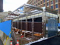
 Boston Landing station construction, March 2016.JPG 4,320 × 3,240; 3.42 MB
-
 Boylston Street pedestrian bridge at Eliot station, March 2016.JPG 4,320 × 3,240; 2.89 MB
-
 Boylston Street pedestrian bridge interior view, March 2016.JPG 4,320 × 3,240; 4.26 MB
-
 Brattle Loop and northbound train at Government Center station, March 2016.JPG 4,320 × 3,240; 2.51 MB
-
 Brattle Loop track at Government Center station, March 2016.JPG 4,320 × 3,240; 2.57 MB
-
 Bussey Bridge (1), March 2016.JPG 4,320 × 3,240; 3.68 MB
-
 Bussey Bridge (2), March 2016.JPG 4,320 × 3,240; 3.32 MB
-
 Bussey Bridge (3), March 2016.JPG 4,320 × 3,240; 3.93 MB
-
 BYD K11 articulated bus at MIT, March 2016.JPG 3,171 × 2,382; 1.79 MB
-
 Capen Street inbound platform, March 2016.JPG 4,320 × 3,240; 3.6 MB
-
 Carlton Street footbridge (1), March 2016.JPG 4,320 × 3,240; 4.66 MB
-
 Carlton Street footbridge (2), March 2016.JPG 4,320 × 3,240; 3.58 MB
-
 Carlton Street footbridge (3), March 2016.JPG 4,320 × 3,240; 5.11 MB
-
 Carving at end of Cazenove Street, April 2016.jpg 4,382 × 2,274; 2.47 MB
-
 Charles MGH station entrance, March 2016.JPG 4,320 × 3,240; 2.62 MB
-
 Chicken Farm crossing, March 2016.JPG 4,320 × 3,240; 4.77 MB
-
 Concord express office, March 2016.JPG 4,320 × 3,240; 3.3 MB
-
 Concord station panorama, March 2016.jpg 3,557 × 2,234; 2.36 MB
-
 Connecticut River Railroad Station (B&M station).jpg 3,000 × 1,670; 1.61 MB
-
 Copley Place, Boston, United States (Unsplash).jpg 2,576 × 3,878; 4.56 MB
-
 Eastbound Blue Line track at Government Center station, March 2016.JPG 4,320 × 3,240; 2.59 MB
-
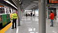
 Eastbound Blue Line train at Government Center station, March 2016.JPG 3,541 × 2,563; 2.82 MB
-
 Eastbound platform exit to Boylston Street from Eliot station, March 2016.JPG 4,320 × 3,240; 3.97 MB
-
 Eliot station facing outbound, March 2016.JPG 4,320 × 3,240; 4.01 MB
-
 Emergency exit doors at Government Center station, March 2016.JPG 4,320 × 3,240; 2.2 MB
-
 Emergency exit stairs at Government Center station, March 2016.JPG 4,320 × 3,240; 2.93 MB
-
 End of ABS on Needham Line, March 2016.JPG 4,320 × 3,240; 5.26 MB
-
 End view of Needham Junction mini-high platform, March 2016.JPG 4,320 × 3,240; 4.03 MB
-
 Englewood Avenue station facing west, March 2016.JPG 4,079 × 3,062; 2.77 MB
-
 Entrance to Valley Road station, March 2016.JPG 4,320 × 3,240; 3.83 MB
-
 Former Mattapan station, March 2016.JPG 4,320 × 3,240; 2.99 MB
-
 Former Needham Center station building, March 2016.JPG 4,320 × 3,240; 3.23 MB
-
 Former staircase at Eliot station, March 2016.JPG 4,320 × 3,240; 3.79 MB
-
 Former staircase pillar at Eliot station, March 2016.JPG 4,320 × 3,240; 3.2 MB
-
 Fourth track space at Forest Hills, March 2016.JPG 4,320 × 3,240; 2.71 MB
-
 Friendship of Salem (without masts).jpg 6,016 × 4,016; 4.38 MB
-
Gov. Baker Signs Landmark Bill to Address Opioid & Heroin Epidemic.webm 2 min 1 s, 1,920 × 1,080; 56.43 MB
-
 Government Center emergency exit construction, March 2016.JPG 4,320 × 3,240; 3.2 MB
-
 Government Center headhouse construction, 2 March 2016.jpg 3,998 × 2,273; 2.1 MB
-
 Government Center station on reopening day, March 2016.jpg 3,907 × 2,268; 2.18 MB
-
 Great Plain Avenue grade crossing at Needham Center station, March 2016.JPG 4,320 × 3,240; 3.5 MB
-
 Green Line panorama at Government Center station, March 2016.jpg 8,177 × 2,546; 5.15 MB
-
 Green Line platform center at Government Center station, March 2016.jpg 4,543 × 2,773; 3.51 MB
-
 Green Line to Blue Line elevator at Government Center station, March 2016.JPG 4,320 × 3,240; 2.8 MB
-
 Green Line to surface elevator at Government Center station, March 2016.JPG 4,320 × 3,240; 2.63 MB
-
 Green Line westbound platform view at Government Center station, March 2016.jpg 5,248 × 2,952; 4.25 MB
-
 Heights Common, Needham Heights, March 2016.JPG 4,320 × 3,240; 4.24 MB
-
 Holdens Taxi Service building, March 2016.JPG 4,320 × 3,240; 3.17 MB
-
 Holyoke Massachusetts City Hall.jpg 1,708 × 2,600; 1.48 MB
-
 Hoosic Tunnel alignment tower.JPG 2,432 × 2,432; 2.96 MB
-
 Hynes Convention Center station southbound bus shelter, March 2016.JPG 4,320 × 3,240; 2.29 MB
-
 Inbound train at Back of the Hill, March 2016.JPG 3,749 × 2,814; 2.09 MB
-
 Landing of stairs to Blue Line at Government Center station, March 2016.JPG 4,320 × 3,240; 2.52 MB
-
 Lobby view of City Hall and Old North Church from Government Center station, March 2016.JPG 4,320 × 3,240; 2.44 MB
-
 Main entrance to Blue Line platform at Government Center station, March 2016.JPG 4,320 × 3,240; 2.05 MB
-
 Main entrance to Hynes Convention Center station, March 2016.JPG 4,320 × 3,240; 3.08 MB
-
 Mary Lyon's Grave, Mount Holyoke Campus.jpg 3,000 × 2,000; 4.16 MB
-
 Massachusetts surface station from Newbury Street, March 2016.JPG 4,320 × 3,240; 2.33 MB
-
 Mattapan Carhouse, March 2016.JPG 4,320 × 3,240; 2.6 MB
-
 Mattapan parking lot, March 2016.JPG 2,754 × 2,071; 1.1 MB
-
 Mattapan station south busway, March 2016.JPG 4,320 × 3,240; 2.54 MB
-
 MBTA 3234 in Mattapan Yard, March 2016.JPG 4,320 × 3,240; 4.68 MB
-
 MBTA 3260 at Mattapan (1), March 2016.JPG 4,320 × 3,240; 2.91 MB
-
 MBTA 3260 at Mattapan (2), March 2016.JPG 4,320 × 3,240; 2.58 MB
-
 MBTA 3263 at Capen Street, March 2016.JPG 4,320 × 3,240; 3.72 MB
-
 MBTA 3263 at Mattapan (1), March 2016.JPG 4,320 × 3,240; 2.9 MB
-
 MBTA 3263 at Mattapan (2), March 2016.JPG 4,320 × 3,240; 2.43 MB
-
 MBTA 3617 at Eliot station, March 2016.JPG 4,320 × 3,240; 3.9 MB
-
 MBTA 3710 near Chicken Farm, March 2016.JPG 4,320 × 3,240; 4.62 MB
-
 MBTA 3843 at Coolidge Corner, March 2016.JPG 3,577 × 2,687; 2.13 MB
-
 MBTA 3877 near Hammond Pond Parkway, March 2016.JPG 2,842 × 2,134; 1.85 MB
-
 MBTA 3884 at Heath Street, March 2016.JPG 4,320 × 3,240; 2.97 MB
-
 MBTA F40PH-2C 1072 River Works.jpg 2,048 × 1,536; 886 KB
-
MBTA Green Line Type 9 Testing.webm 19 s, 3,840 × 2,160; 55.67 MB
-
 MBTA route 30 bus on Washington Street, March 2016.JPG 4,320 × 3,240; 3.07 MB
-
 MBTA route 34 bus on Washington Street, March 2016.JPG 2,829 × 2,121; 1.37 MB
-
 MBTA route 39 bus at Bynner Street, March 2016.jpg 4,320 × 3,240; 4.77 MB
-
 MBTA route 41 bus at Canary Square, March 2016.JPG 4,320 × 3,240; 2.96 MB
-
 MBTA route 430 bus at Malden Center, March 2016.jpg 3,264 × 2,448; 2.68 MB
-
 MBTA route 59 bus turning at Needham Junction, March 2016.JPG 3,007 × 2,256; 1.56 MB
-
 MBTA route 608 bus at Haymarket, March 2016.JPG 4,320 × 3,240; 2.86 MB
-
 MBTA train at Andover, March 2016.JPG 4,320 × 3,240; 2.61 MB
-
 Millis Branch and Needham Line bridges at Needham Junction, March 2016.jpg 4,521 × 2,317; 3.22 MB
-
 Mini-high platform at Heath Street, March 2016.JPG 4,320 × 3,240; 4.62 MB
-
 Mini-high platform at Needham Center station, March 2016.JPG 4,320 × 3,240; 3.82 MB
-
 Mini-high platform at Needham Heights station, March 2016.JPG 4,320 × 3,240; 4.09 MB
-
 Mini-high platform at Needham Junction station, March 2016.JPG 4,320 × 3,240; 4.24 MB
-
 Mini-high ramps at Longwood station, March 2016.JPG 4,320 × 3,240; 4.55 MB
-
 Mount Holyoke College Mary Lyon Hall.jpg 3,000 × 2,289; 4.21 MB
-
 Needham Center station platform (1), March 2016.JPG 4,320 × 3,240; 3.79 MB
-
 Needham Center station platform (2), March 2016.JPG 4,320 × 3,240; 3.93 MB
-
 Needham Center station, March 2016.JPG 4,160 × 3,125; 2.62 MB
-
 Needham Heights station from Hunnewell Street, March 2016.JPG 2,766 × 2,091; 1.81 MB
-
 Needham Heights station from West Street, March 2016.JPG 3,837 × 2,883; 2.18 MB
-
 Needham Heights station platform (1), March 2016.JPG 4,320 × 3,240; 4.37 MB
-
 Needham Heights station platform (2), March 2016.JPG 4,320 × 3,240; 4.37 MB
-
 Needham Heights station platform (3), March 2016.JPG 4,320 × 3,240; 4.01 MB
-
 Needham Heights station platform (4), March 2016.JPG 4,320 × 3,240; 3.45 MB
-
 Needham Heights station shelter and parking lot, March 2016.JPG 3,496 × 2,624; 2.15 MB
-
 Needham Heights station shelter facing south, March 2016.JPG 4,320 × 3,240; 2.85 MB
-
 Needham Junction bus loop and parking lot, March 2016.JPG 4,320 × 3,240; 3.8 MB
-
 Needham Junction bus shelter, March 2016.JPG 4,320 × 3,240; 4.01 MB
-
 Needham Junction station facing east, March 2016.JPG 4,320 × 3,240; 4.61 MB
-
 Needham Junction station from parking lot, March 2016.JPG 4,320 × 3,240; 3.9 MB
-
 Needham Junction station from the southeast, March 2016.JPG 4,320 × 3,240; 3.1 MB
-
 Needham Junction station from tracks HDR, March 2016.jpg 2,048 × 1,537; 4.09 MB
-
 Needham Junction station HDR, March 2016.jpg 1,853 × 1,392; 3.6 MB
-
 Needham Junction wye from station, March 2016.JPG 4,320 × 3,240; 4.17 MB
-
 Needham Layover from Rosemary Street, March 2016.JPG 4,320 × 3,240; 3 MB
-
 Needham Layover from West Street, March 2016.JPG 4,320 × 3,240; 3.76 MB
-
 New York Central logo on Highland Branch bridge, March 2016.JPG 4,320 × 3,240; 3.4 MB
-
 Newton Centre station express office, March 2016.JPG 4,320 × 3,240; 2.95 MB
-
 Newton Centre station from Herrick Road (1), March 2016.JPG 4,320 × 3,240; 4.18 MB
-
 Newton Centre station from Herrick Road (2), March 2016.JPG 1,732 × 1,296; 642 KB
-
 Newton Centre station from Herrick Road (3), March 2016.JPG 3,832 × 2,878; 3.05 MB
-
 Newton Centre station from Union Street, March 2016.jpg 3,841 × 2,313; 2.13 MB
-
 Newton Centre station HDR, March 2016.jpg 2,048 × 1,559; 4.15 MB
-
 Newton Centre station platform view, March 2016.JPG 4,320 × 3,240; 2.66 MB
-
 Newton Centre station staircase, March 2016.JPG 4,320 × 3,240; 3.3 MB
-
 Newton Centre station west side, March 2016.JPG 4,320 × 3,240; 3.1 MB
-
 North Congregational Church Springfield MA.jpg 2,862 × 3,000; 3.08 MB
-
 North stairs at Government Center station, March 2016.jpg 2,965 × 3,515; 2.4 MB
-
 Northbound Green Line platform facing north at Government Center station, March 2016.JPG 4,320 × 3,240; 3.24 MB
-
 Northbound Green Line track at Government Center station, March 2016.JPG 4,320 × 3,240; 2.6 MB
-
 Northbound route 39 bus stop at Heath Street, March 2016.JPG 4,320 × 3,240; 4.51 MB
-
 Northbound route 39 bus stop at Perkins Street, March 2016.JPG 4,320 × 3,240; 5.23 MB
-
 Old and new Mattapan stations, March 2016.jpg 3,729 × 1,882; 1.54 MB
-
 Orange Line substation at Sullivan Square, March 2016.JPG 4,320 × 3,240; 2.23 MB
-
 Orange Line yard at Forest Hills, March 2016.JPG 4,320 × 3,240; 4.16 MB
-
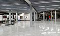
 Paid lobby at Government Center station, March 2016.JPG 4,320 × 3,240; 2.42 MB
-
 Power changeover at Silver Line Way inbound, March 2016.JPG 4,320 × 3,240; 2.68 MB
-
 Ramps to Riverway at Longwood station, March 2016.JPG 4,320 × 3,240; 4.2 MB
-
 Realigned Red Line tracks on Longfellow Bridge, March 2016.JPG 4,320 × 3,240; 3.8 MB
-
 Reservoir station busway, March 2016.JPG 3,762 × 2,821; 2.68 MB
-
 S tile sign at Government Center, March 2016.JPG 4,320 × 3,240; 2.81 MB
-
 Salem Harbor Station Demolition.jpg 6,016 × 4,016; 5.36 MB
-
 Scollay tile sign at Government Center, March 2016.JPG 4,320 × 3,240; 2.86 MB
-
 Scollay Under tile sign (1) at Government Center, March 2016.JPG 4,320 × 3,240; 3.09 MB
-
 Scollay Under tile sign (2) at Government Center, March 2016.JPG 4,320 × 3,240; 2.79 MB
-
 Scollay Under tile sign (3) at Government Center, March 2016.JPG 4,320 × 3,240; 2.87 MB
-
 Scollay Under trolley platform remains, March 2016.JPG 4,320 × 3,240; 2.82 MB
-
 Second track construction in Andover, March 2016.JPG 4,320 × 3,240; 3.25 MB
-
 Secondary stairs to Blue Line at Government Center station, March 2016.JPG 4,320 × 3,240; 2.73 MB
-
 Shelter at Longwood station, March 2016.JPG 4,320 × 3,240; 3.51 MB
-
 Silver Line shelter, 306 Northern Avenue inbound, March 2016.JPG 3,102 × 2,338; 1.21 MB
-
 Silver Line shelter, Northern Avenue at Tide Street inbound, March 2016.JPG 4,320 × 3,240; 3.04 MB
-
 Silver Line shelter, Northern Avenue at Tide Street outbound, March 2016.JPG 4,320 × 3,240; 3.46 MB
-
 Silver Line Way station, March 2016.JPG 3,775 × 2,834; 1.95 MB
-
 South stairs at Government Center station, March 2016.JPG 4,320 × 3,240; 2.66 MB
-
 Southbound Green Line platform at Government Center station, March 2016.JPG 4,320 × 3,240; 2.76 MB
-
 Southbound Green Line train at Government Center station, March 2016.JPG 4,320 × 3,240; 2.91 MB
-
 Southbound route 39 bus stop at VA Medical Center, March 2016.JPG 4,320 × 3,240; 3.37 MB
-
 Springfield Armory National Historic Site.jpg 3,000 × 2,450; 2.48 MB
-
 St Francis Statue 2.JPG 3,024 × 4,032; 5.78 MB
-
 St Francis Statue 3.JPG 3,024 × 4,032; 5.04 MB
-
 Stairs to Blue Line and Scollay Under mosaic at Government Center station, March 2016.JPG 4,320 × 3,240; 3.04 MB
-
 Third Railroad Station from Essex Street, March 2016.JPG 4,320 × 3,240; 2.96 MB
-
 Track misters at Government Center station, March 2016.JPG 4,320 × 3,240; 3.33 MB
-
 Trolley pole at Evergreen Street, March 2016.JPG 4,320 × 3,240; 3.31 MB
-
 Unpaid lobby at Government Center station, March 2016.JPG 4,320 × 3,240; 2.81 MB
-
 Valley Road station facing inbound, March 2016.JPG 4,320 × 3,240; 4.3 MB
-
 Valley Road station from stairs, March 2016.jpg 4,320 × 3,240; 3.55 MB
-
 Valley Road station stairs, March 2016.JPG 4,320 × 3,240; 3.92 MB
-
 Valley Road station, March 2016.jpg 5,248 × 2,952; 6.31 MB
-
 Washington Street south of Forest Hills, March 2016.JPG 3,717 × 2,789; 2.29 MB
-
 Ye Olde Union Oyster House.jpg 2,988 × 5,312; 3.48 MB

.jpg)


,_March_2016.JPG)
,_March_2016.JPG)
,_March_2016.JPG)


,_March_2016.JPG)
,_March_2016.JPG)
,_March_2016.JPG)


.jpg)
.jpg)


.jpg)


,_March_2016.JPG)
,_March_2016.JPG)

,_March_2016.JPG)
,_March_2016.JPG)


,_March_2016.JPG)
,_March_2016.JPG)


,_March_2016.JPG)
,_March_2016.JPG)
,_March_2016.JPG)
,_March_2016.JPG)


,_March_2016.JPG)
,_March_2016.JPG)
,_March_2016.JPG)


_at_Government_Center,_March_2016.JPG)
_at_Government_Center,_March_2016.JPG)
_at_Government_Center,_March_2016.JPG)


